I created a series of maps to help the Seattle Animal Shelter (a city facility) understand where their customers and volunteers live, with an eye to better serving economically distressed zip codes.
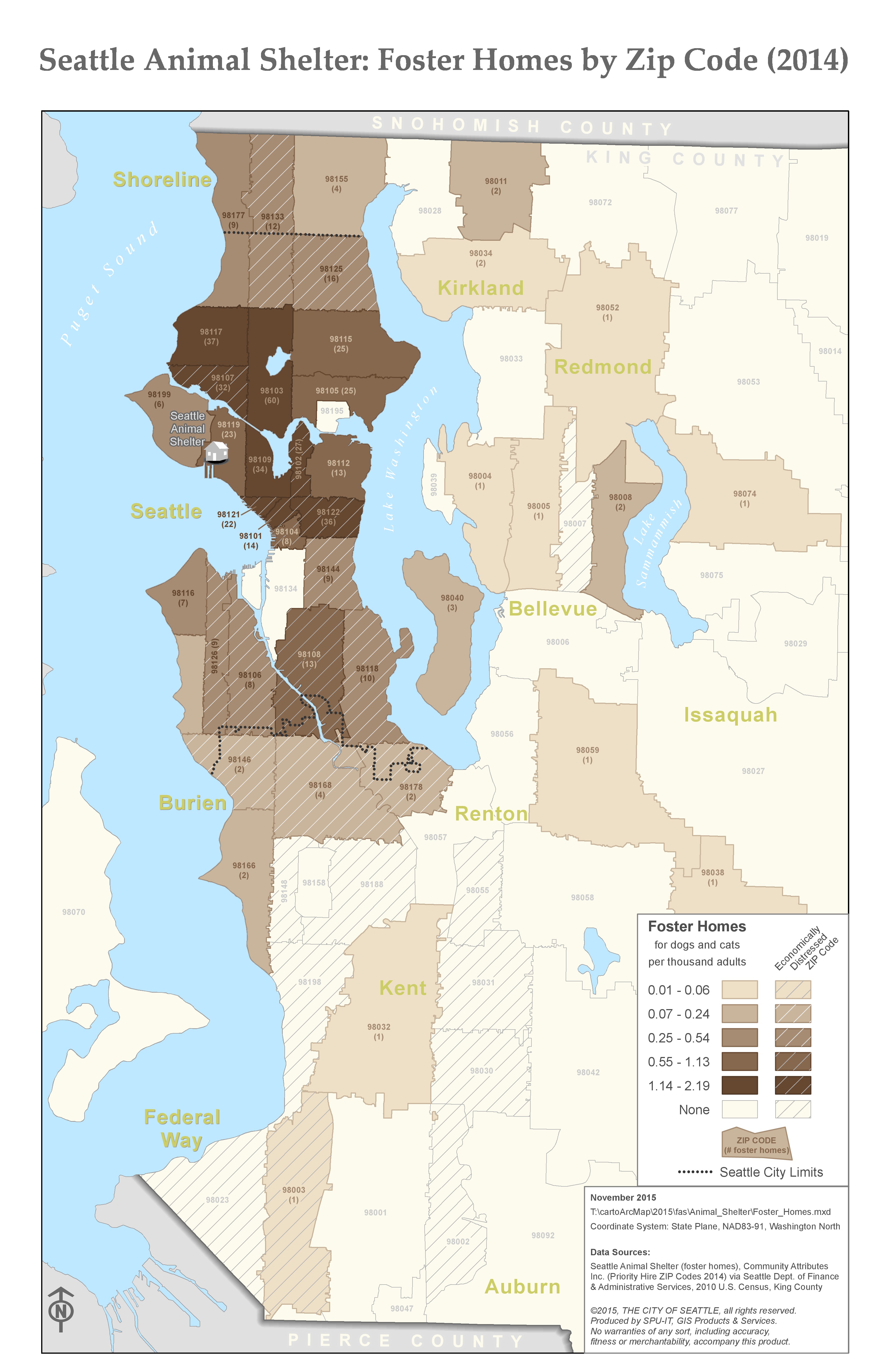
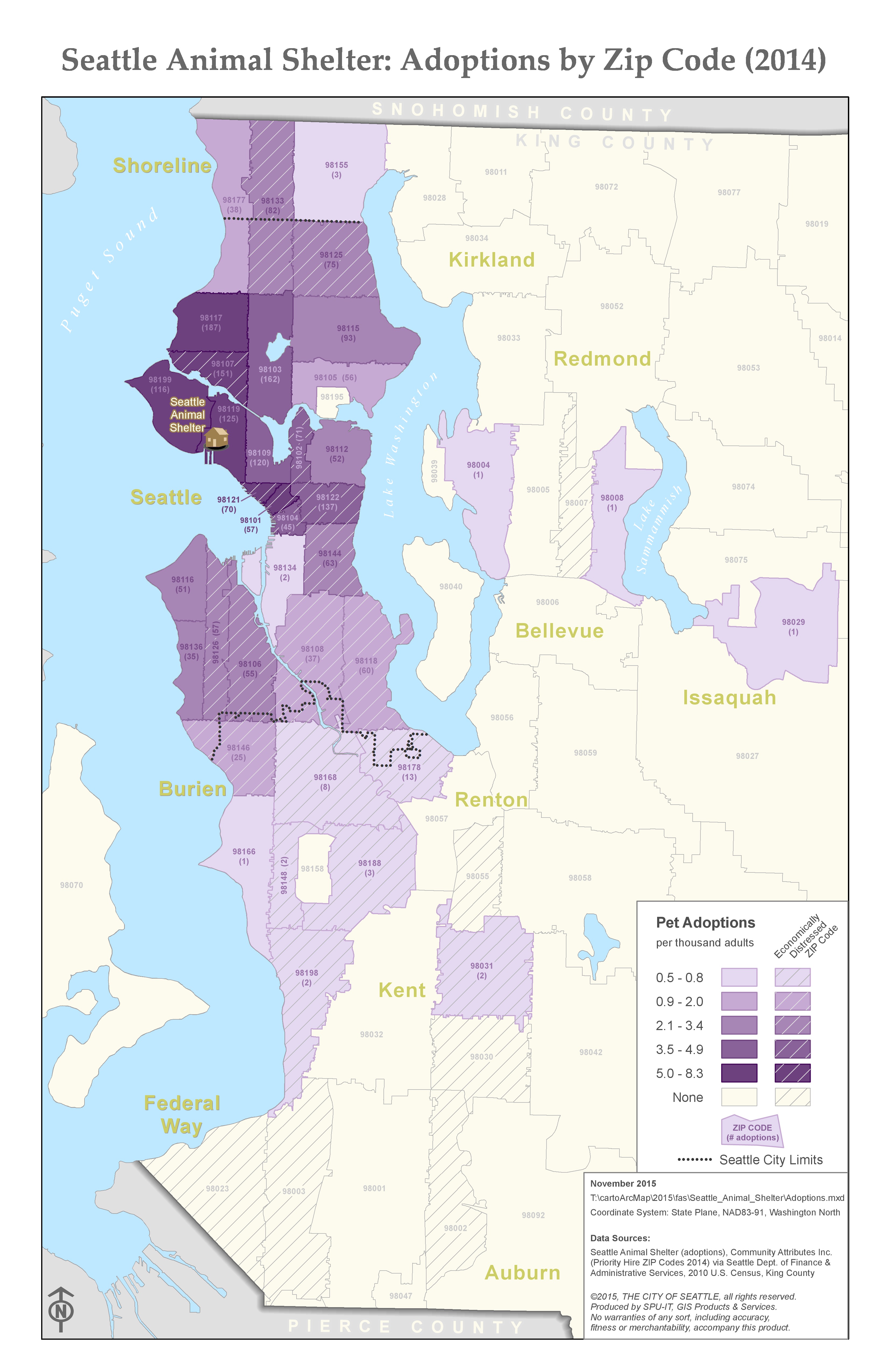
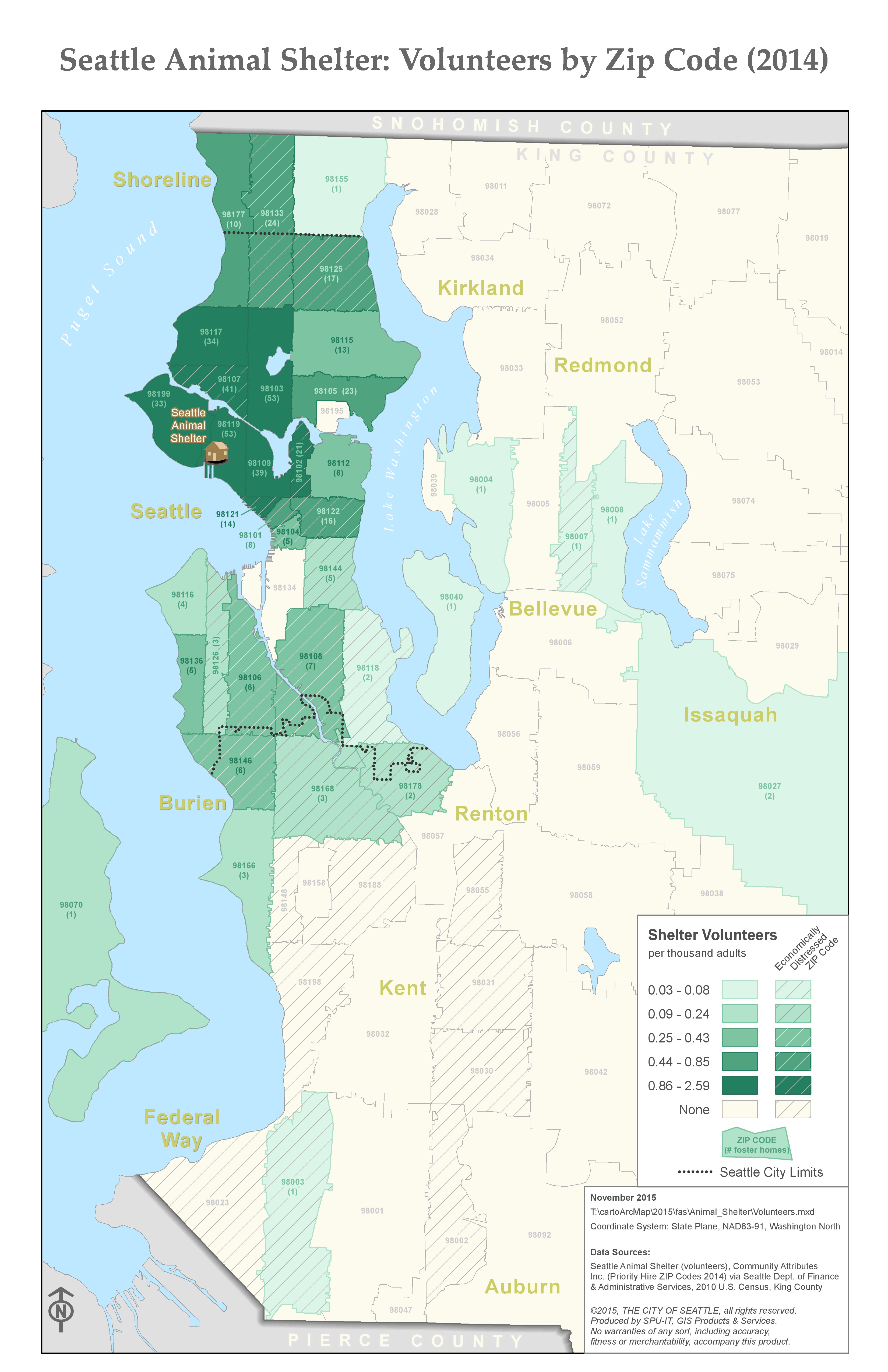
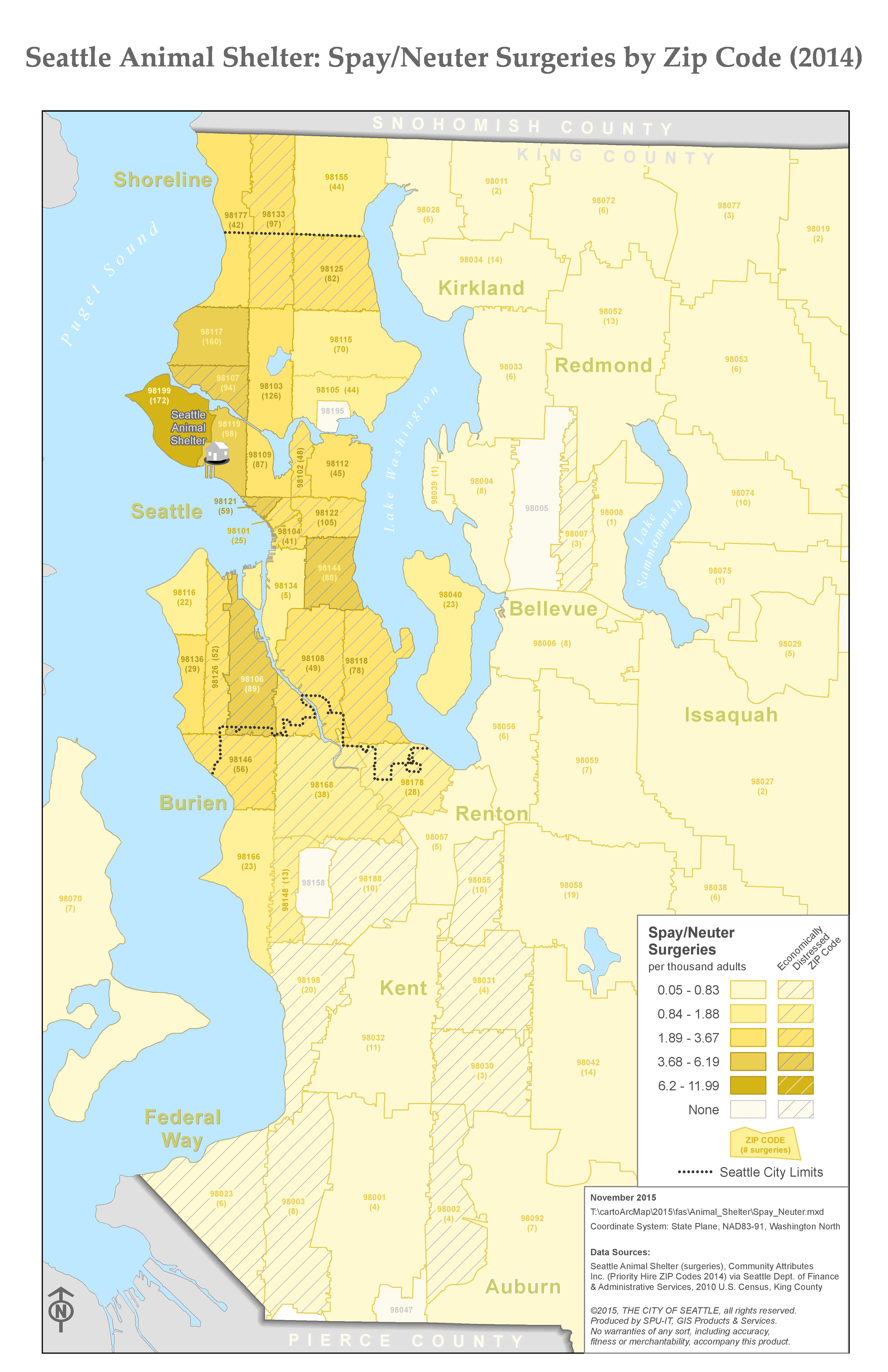
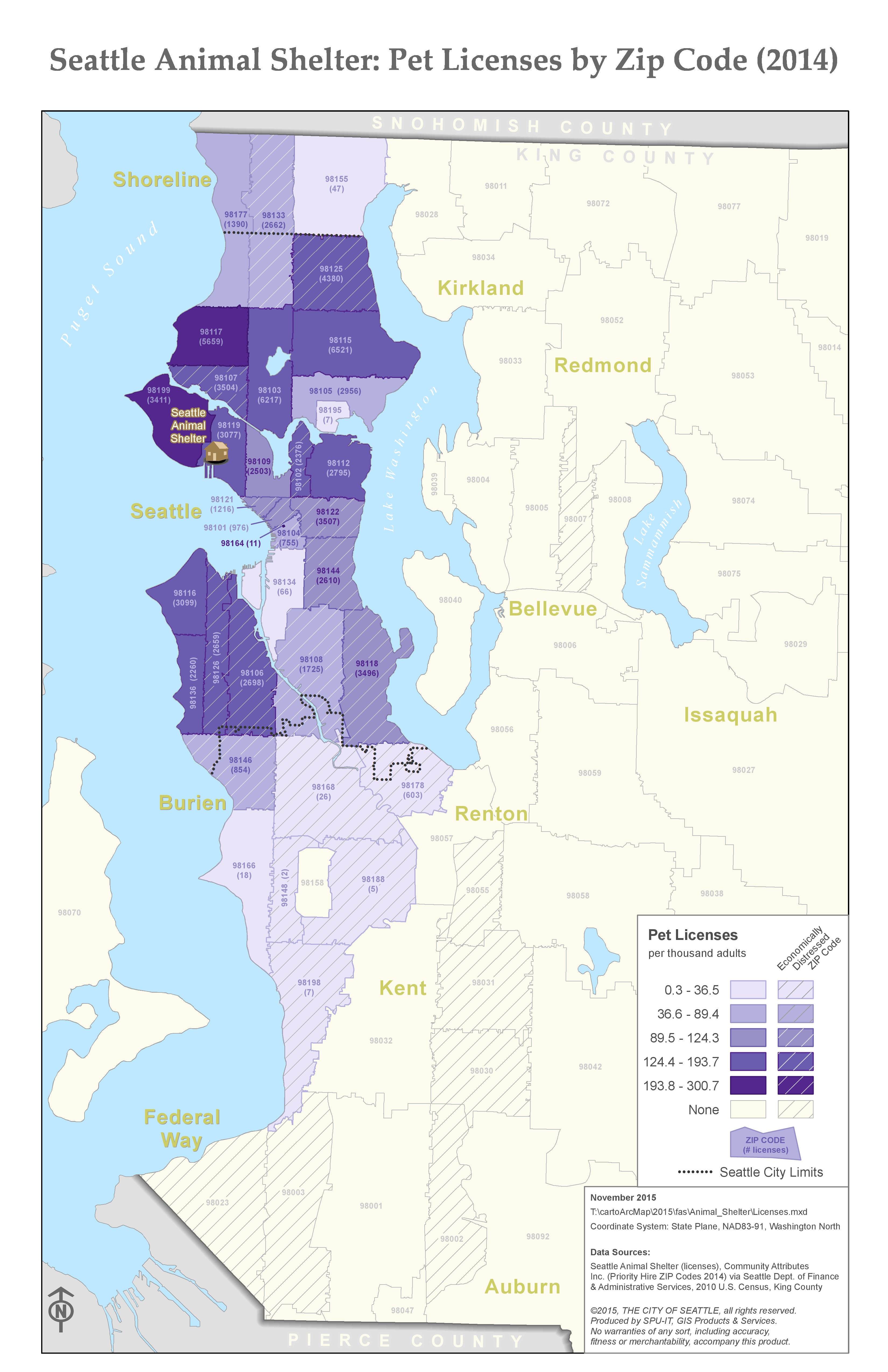
I created a series of maps to help the Seattle Animal Shelter (a city facility) understand where their customers and volunteers live, with an eye to better serving economically distressed zip codes.